 Hargis + Associates, Inc. is currently providing hydrogeologic consulting services to the Mojave Water Agency (MWA) for the Oeste Demonstration Recharge
. The MWA is responsible for water resource management for approximately 4,900 square miles of the High Desert in San Bernardino County. The region is largely dependent on groundwater supply, and groundwater basins within the MWA service area have been adjudicated due to long-term overdraft. To meet future water demands, the MWA is evaluating managed aquifer recharge to increase its capacity to store and recover State Water Project water and provide future long-term replenishment of the regional aquifer.
Hargis was retained to provide hydrogeology support for well installations and infiltration testing for a planned surface recharge facility on MWA land located adjacent to the California aqueduct in the Oeste Sub-basin. Surface geophysics and small-scale infiltration testing suggest the location may have subsurface conditions favorable for a surface spreading groundwater recharge project.
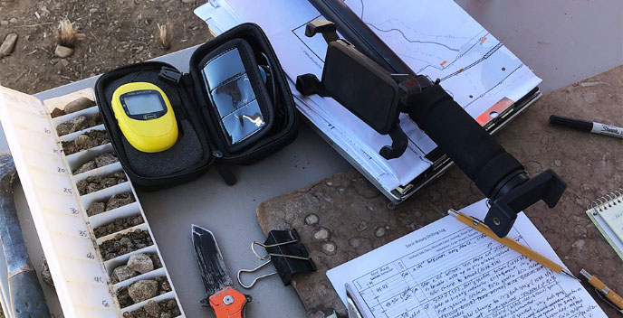
Hargis provided planning and oversight for the design and installation of two monitoring wells located adjacent to the planned location of the future recharge ponds. The wells were installed to confirm favorable subsurface conditions for recharge, to monitor regional aquifer water levels and water quality, and to monitor the infiltration front during larger scale infiltration testing and longer-term recharge events. Hargis developed technical specifications and design for the monitor wells, assisted MWA with bid support and selection of a drilling contractor, and provided field oversight during drilling and installation of the monitor wells. Monitor well design included considerations for using the wells for monitoring advancement of the infiltration front during larger scale infiltration testing.
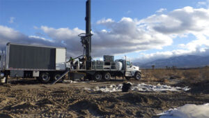
A 400-foot borehole was advanced using rotosonic drilling methods to obtain reliable lithologic information, and a dry monitor well was installed to identify potential water perching during future recharge events. A regional water table monitor well was installed using air rotary casing hammer (ARCH) drilling methods to a depth of 650 feet.
Monitoring of the infiltration front during future recharge events will be accomplished by conducting repeated downhole electromagnetic induction geophysical logging of the regional well.
Ongoing hydrogeology support for infiltration testing includes site conceptual model development, infiltration front modeling, development of infiltration testing specifications, and interpretation of data collected during future recharge events.
KEY ACCOMPLISHMENTS
• Developed technical specifications for drilling and installation of two monitoring wells.
• Provided bid support and field oversight for well drilling and construction using rotosonic and air rotary casing hammer drilling methods.
• Providing technical support for the design and implementation of infiltration testing using surface spreading ponds.