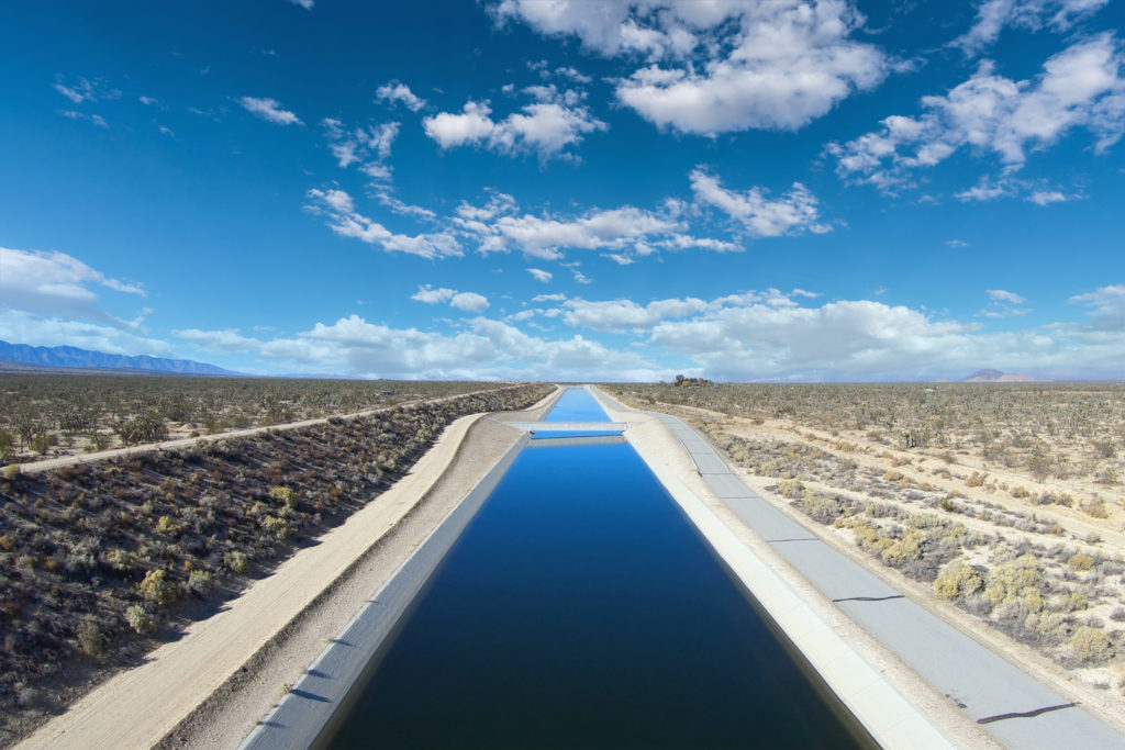
Extreme drought conditions have ravaged portions of the western United States in recent years, leaving water resource planners in a tough position to ensure adequate water supplies are available for their service areas. Many have turned to managed aquifer recharge (MAR) to store excess water supplies available during non-drought times for use during future times when water supplies may fall short. These projects include a variety of MAR concepts including surface spreading and direct injection using injection wells, dry wells, and drains.
Facing tight budgets and pressure to comply with drought regulations like California’s Sustainable Groundwater Management Act, water supply agencies need every advantage to ensure the success of their projects. This blog outlines a four-stage site screening process for a surface spreading recharge approach.
What is the Surface Spreading Method of Managed Aquifer Recharge?
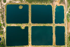
Surface spreading recharge involves placing water into ponds or other surface features to percolate through the subsurface and recharge groundwater supplies for banking or future extraction and use.
Types of surface spreading recharge include
- in-channel recharge using existing streams and river channels
- engineered recharge basins
- use of other unimproved land or farmland
Benefits of surface spreading recharge can include
- the ability to utilize excess water that would otherwise be lost due to surface flow out of the service area or loss of water allocations due to not being used during a set allocation period
- replenishing groundwater supplies in over-drafted groundwater basins
- providing additional riparian and wildlife habitats and recreation
What to Consider When Choosing a Managed Aquifer Recharge Location
Now, let’s dive into the four conceptual processes to consider in selecting a site which will significantly improve your chances of implementing a successful recharge project. These considerations are location constraints, surface conditions, subsurface conditions, and engineering and operational challenges.
1. Are There Constraints Due to Site Location?
The obvious first consideration is to determine who owns the land and if negotiating access for the project is feasible. Next, consider the distance from the water source, proximity to a power source and existing infrastructure, distance to supply wells that may be used to recover the recharged water, and presence of nearby existing wells and recharge projects that may be impacted by the project. Additionally, conducting a careful review of surrounding land use will reveal potential environmental issues that may impact the project. Specifically, known contamination sites or the presence of environmentally sensitive habitats and species present significant challenges.
2. What are the Surface Conditions?
Surface conditions such as topography and surficial soil types need to be evaluated to identify if desirable conditions exist. Site topography can indicate the presence of potential drainage issues that may be detrimental to the project, and potential for flooding. Surficial soil type needs to be identified to confirm the presence of high permeability surface soils that will allow water to infiltrate into the subsurface at a sufficient rate and without impediment. Additionally, added costs due to potential surface engineering design issues need to be considered.
3. Do Favorable Subsurface Conditions Exist?
Subsurface conditions such as soil type, depth to groundwater, depth to bedrock, and existing water quality need to be evaluated. To achieve groundwater recharge, the applied water needs to travel through the unsaturated zone to reach the groundwater table.
The ability of water to successfully reach the groundwater table will depend largely on the type of soil present between land surface and groundwater table. The presence of coarse-grained soils in the unsaturated zone will facilitate timely and unhindered travel of applied water through the unsaturated zone to the groundwater table. If fine-grained layers are present, they may cause infiltrating water to perch and pond, inhibiting or greatly slowing down the vertical movement of water toward the groundwater table. If the fine-grained layers are laterally continuous, the potential exists for sufficient ponding and lateral spread such that infiltrated water may daylight at the surface causing potential flooding and other undesirable effects at the surface.
The depth to groundwater is another important consideration that affects the time it takes infiltrated water to recharge groundwater. The depth to bedrock needs to be considered along with depth to groundwater to evaluate if the amount of storage in the unsaturated zone is acceptable for the project.
Existing groundwater quality should be evaluated to determine if degraded groundwater quality is present and likely to adversely affect the quality of applied water for future beneficial uses. Likewise, water quality of the applied water needs to be evaluated to identify potential negative effects on groundwater quality.
4. Does the Site Present Additional Engineering Costs or Operation Considerations?
Factors affecting engineering design of the project need to be considered to identify added costs or operations difficulties. This could include presence or lack of infrastructure, vegetation management, access and regulatory issues that my affect maintenance schedules, maintenance logistics, vector and insect control, and weather effects such as erosion due to wind. These factors may result in increased costs to build and maintain the project.
Initial Site Screening is the Key
Most MAR projects begin with several qualified potential site locations. Each site should be carefully screened to identify which has the best likelihood of a successful project outcome. To simplify the site screening process, the sites being considered can be systematically ranked based on components in the four conceptual considerations – location constraints, surface conditions, subsurface conditions, and engineering and operational challenges.
Once the site screening process is complete, the selected site or site(s) retained can be further evaluated with additional site characterization, infiltration testing, and modeling prior to full-scale implementation of the project. A thoughtful and well-designed investigation approach can increase the likelihood of a desirable surface spreading project outcome.
Case Study: Oeste Demonstration Recharge Project for the Mojave Water Agency
The Mojave Water Agency (MWA) is responsible for water resource management for approximately 4,900 square miles of the High Desert in San Bernardino County. The region is largely dependent on groundwater supply, and groundwater basins within the MWA service area have been adjudicated due to long-term overdraft. To meet future water demands, the MWA is evaluating managed aquifer recharge to increase its capacity to store and recover State Water Project water and provide future long-term replenishment of the regional aquifer.
Surface geophysics and small-scale infiltration testing suggest the location may have subsurface conditions favorable for a surface spreading groundwater recharge project. Read more about Hargis work on this project in the managed aquifer recharge case study.
Working with an experienced team of hydrogeologists and environmental engineers can streamline this daunting process. Hargis has served water providers for decades. We understand the everchanging regulatory framework and demanding nature of today’s public utilities. Contact us for details on assured water supply evaluations, sustainable groundwater management, groundwater exploration & development, and environmental characterization.
ABOUT THE AUTHOR

Stacia L. Prazen, MS, RG, PG, CHG
Senior Hydrogeologist
Hargis + Associates, Inc.
sprazen@hargis.com
LinkedIn: https://www.linkedin.com/in/stacia-prazen/
Stacia has professional experience in hydrogeology since 1998, participating in environmental and water resource projects from inception through execution. Her experience includes complex hydrogeologic investigations for private, public, and government clients. Her areas of specialization include project management support, numerical modeling, site characterization studies including conceptual site model development, remedial investigations and feasibility studies, remediation system performance evaluations and optimization, and local and regional water resource studies.
*Stacia is no longer with Hargis + Associates, Inc. For questions regarding this blog, please email hargisinfo@hargis.com.